

From EVs and batteries to autonomous vehicles and urban transport, we cover what actually matters. Delivered to your inbox weekly.


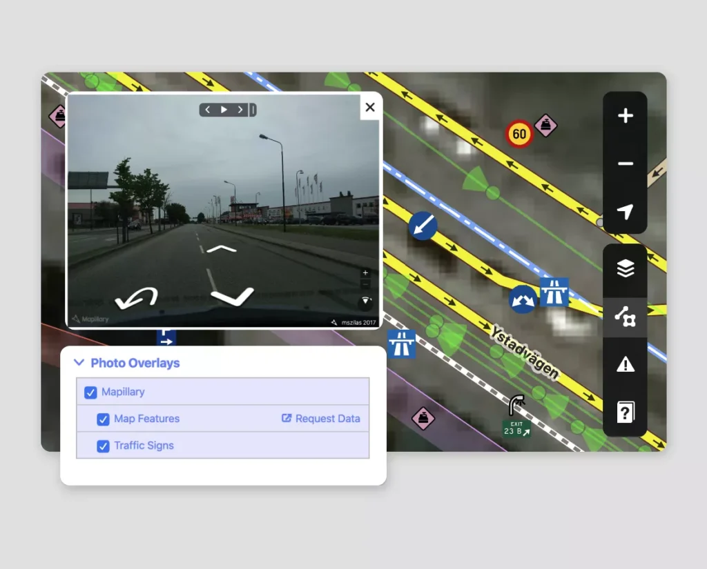
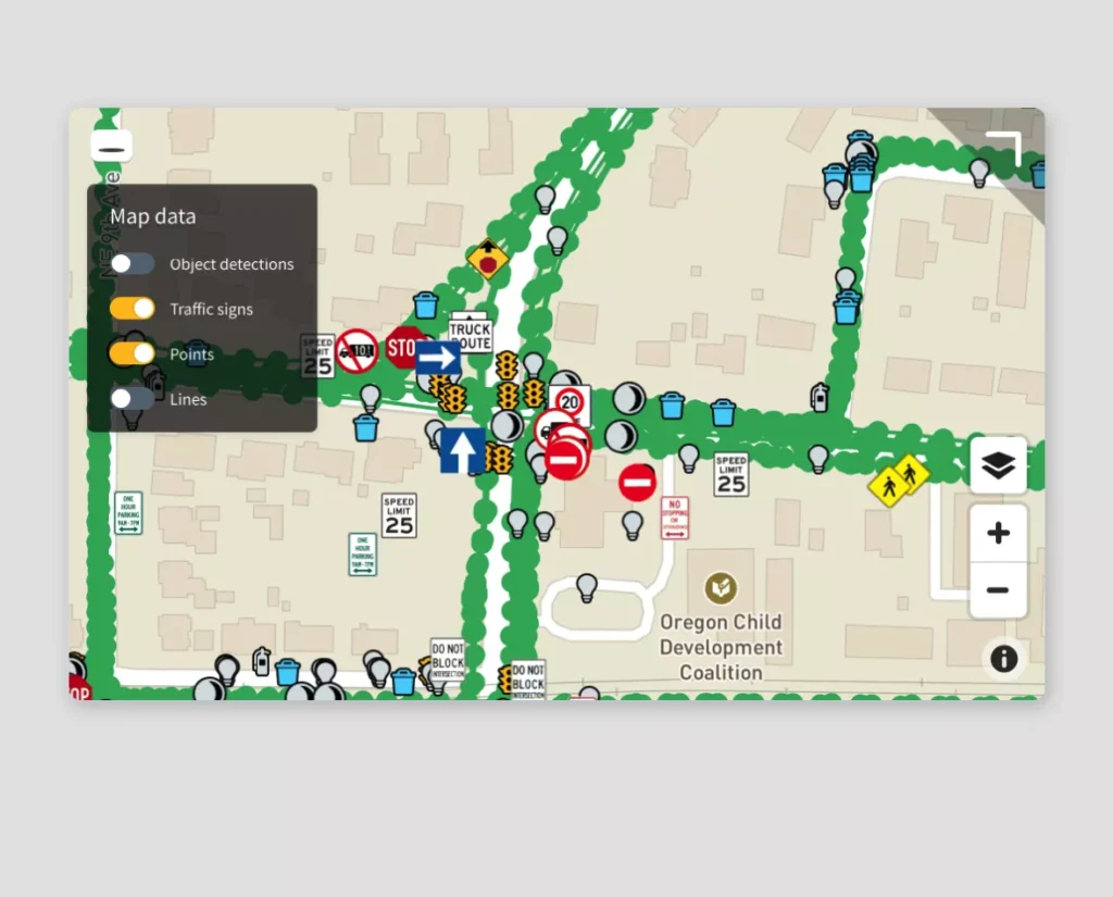
Users capture geotagged imagery using smartphones, action cams, or dash cams. Mapillary anonymizes (blurs faces/license plates) before aggregating images to generate smooth, navigable 3D views along streets and trails.
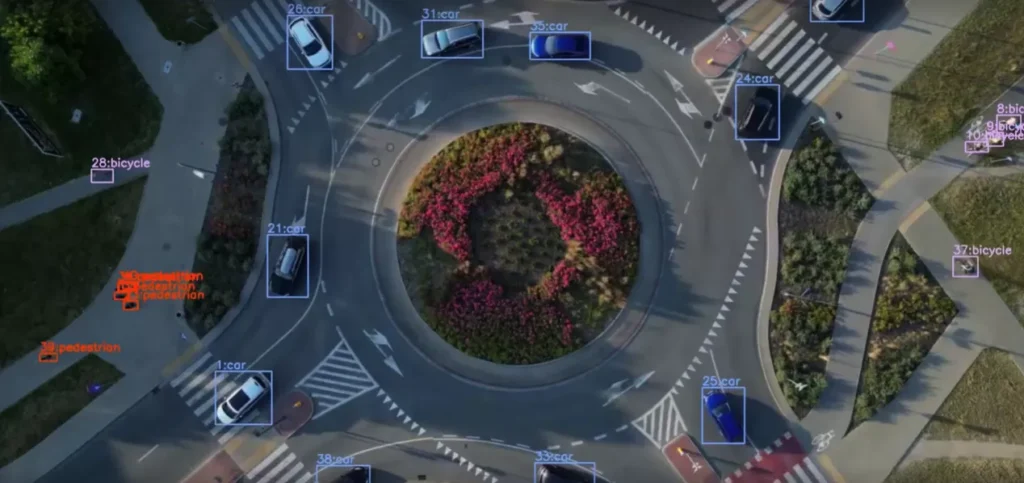
The platform applies computer vision to identify and extract over 96 object types — traffic signs, street features, pavement defects — and converts them into GIS-ready formats like GeoJSON or shapefiles. These outputs support asset management, urban planning, and autonomous vehicle perception systems.


Join the Charging Stack directory and make your company visible to investors, partners, and industry leaders.
01
Seen by decision-makers across the EV, mobility, and infrastructure sectors.
02
Your listing is structured, vetted, and placed among top innovators.
03
Receive direct inquiries from partners and stakeholders who matter.