


Founded in 2013 and headquartered in Malmö, Sweden, Mapillary allows users and organizations to capture street-level photos using smartphones, action cameras, and dash cams.
The platform stitches and processes these images via computer vision to extract geospatial features, such as traffic signs, lane markings, potholes, and utility poles, making them available for mapping, infrastructure planning, and autonomous vehicle systems.
In June 2020, Mapillary was acquired by Meta (formerly Facebook), joining its geospatial and AI infrastructure initiatives.
Company Snapshot
Industry
Geospatial, Computer Vision, Mapping-as-a-Service
Founded
2013
Headquarters
Malmö, Sweden (operations integrated into Meta, Menlo Park, CA)
Employees
11–50 pre-acquisition; integrated into Meta’s teams of 100+ engineers
Key Partners


Product
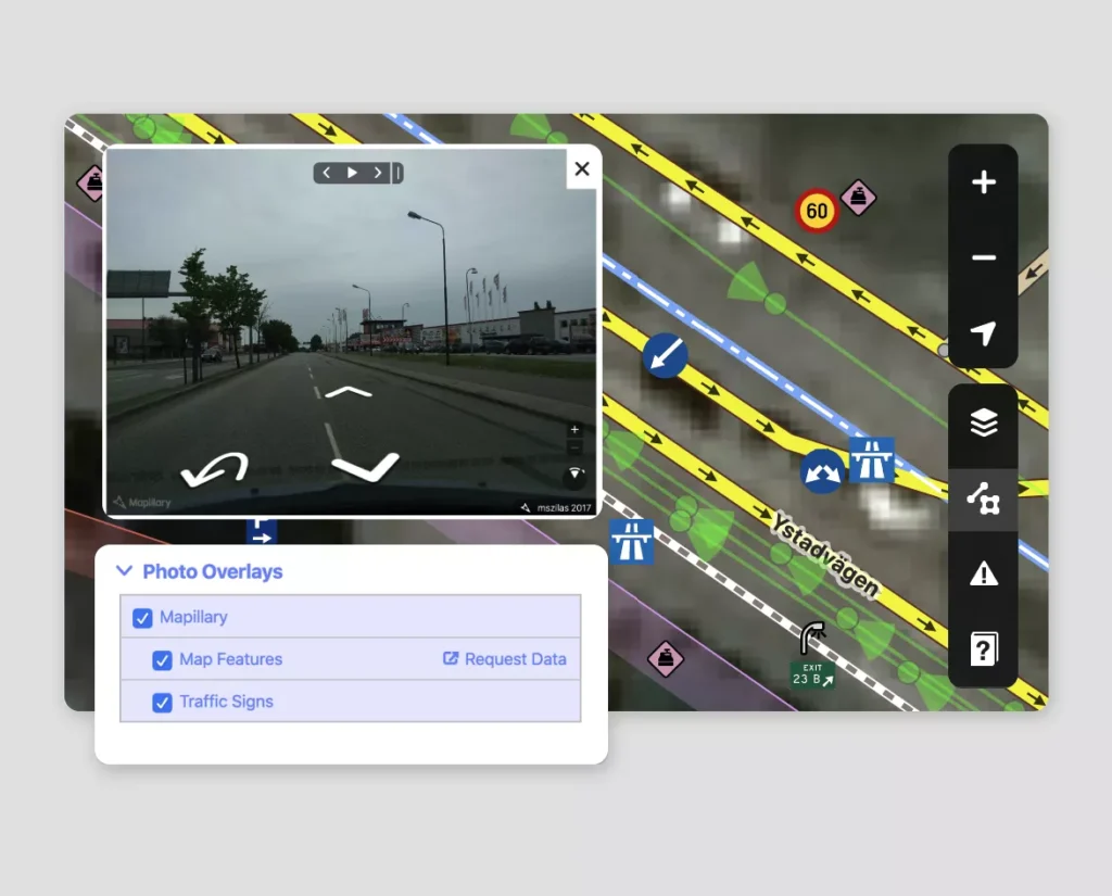
Users capture geotagged imagery using smartphones, action cams, or dash cams. Mapillary anonymizes (blurs faces/license plates) before aggregating images to generate smooth, navigable 3D views along streets and trails.
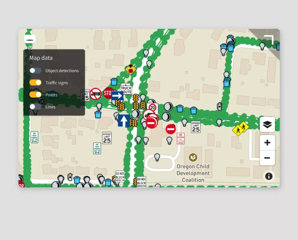
The platform applies computer vision to identify and extract over 96 object types — traffic signs, street features, pavement defects — and converts them into GIS-ready formats like GeoJSON or shapefiles. These outputs support asset management, urban planning, and autonomous vehicle perception systems.
Team

Jan Erik Solem
founder, engineering director @ meta

Johan Gyllenspetz
co-founder, engineering manager @ meta

Yubin Kuang
co-founder, engineering manager @ meta
Contact information
Get your mobility startup listed
Join the Charging Stack directory and make your company visible to investors, partners, and industry leaders.
01
Proven Visibility
Seen by decision-makers across the EV, mobility, and infrastructure sectors.
02
Credible Positioning
Your listing is structured, vetted, and placed among top innovators.
03
Direct Access
Receive direct inquiries from partners and stakeholders who matter.